


Thank you for using our app!
This version fixes small bugs.
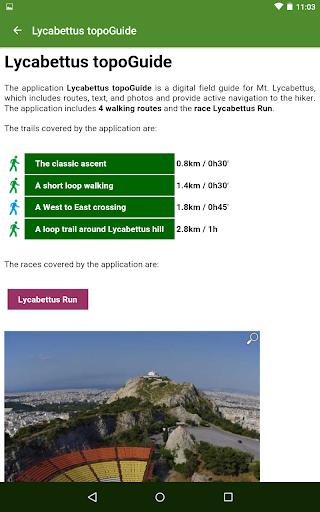
Lycabettus topoguide is a digital field guide for the most notorious hill of Athens. It includes routes, descriptions and photos for 4 walks and hiking trails and 1 race for Lycabettus hill, Athens, Attica, Greece. Each trail has a description, photos and a POIs list.
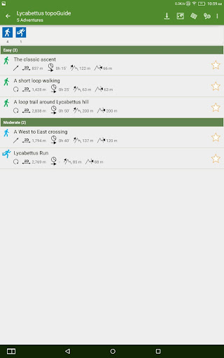
The trails are:
1. The classic ascent to the summit
2. A short loop walking
3. A loop trail around Mt. Lycabettus
4. A West to East crossing
5. Lycabettus Run
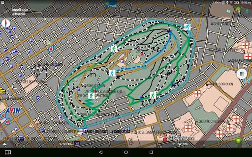
The application offers detailed offline maps and an extensive introduction on geology, history and the nature of Lycabettus. The app offers also a useful list of POIs with a comprehensive search engine.
In the field, the app identifies the nearest adventure, guides you to it and then along it by displaying messages and warnings on every junction or other important location. On each Point of Interest, photos and texts are displayed on the map. If the hiker gets off-trail, the app indicates the shorter way to get back safely.
The cartographic company AnaDigit, creator of the application, has issued previously paper field guides, as well as hundreds hiking maps for Greece (maps of Crete, Zagori, Sifnos, Naxos and other Aegean islands).