

First release
Gramos topoguide is a digital field guide for hiking in Mt. Gramos .
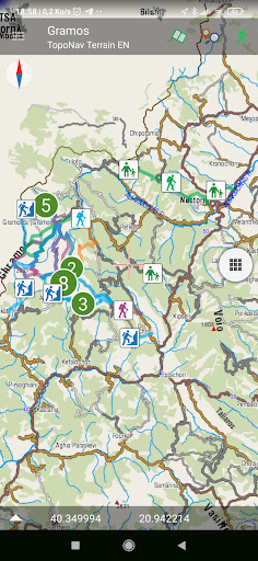
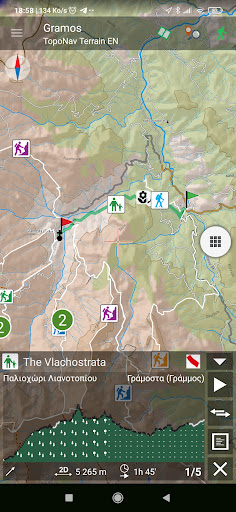
It includes routes, descriptions and photos for 28 hiking and mountaineering trails. Each trail has an elevation profile, a statistic analysis, a detailed description, several photos and a POIs list.
The application offers detailed offline maps and an extensive introduction on geography, geology, the most important settlements and monuments, and the nature of Pelion. The app offers also a useful list of POIs with a comprehensive search engine.
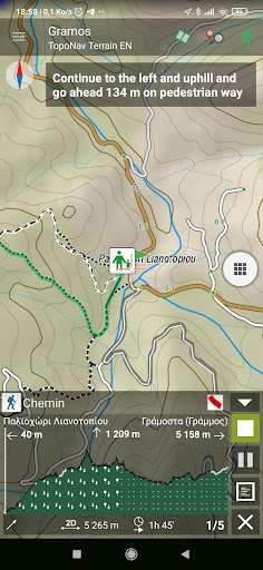
In the field, the app identifies the nearest adventure, guides you to it and then along it by displaying messages and warnings on every junction or other important location. On each Point of Interest, photos and texts are displayed on the map. If the hiker gets off-trail, the app indicates the shorter way to get back safely.
The cartographic company AnaDigit, creator of the application, has issued hundreds of hiking maps for Greece (eg. maps of Kalymnos, Santorini, Crete, Mt. Olympus, Zagori, Sifnos, Naxos and other Aegean islands).