


• Updates to Navionics charts + improvements to interface for ease of use.
• You can now set waypoints and see your GPS track on Navionics charts.
• Navionics high-resolution SonarChart™ crowdsourced water depths.
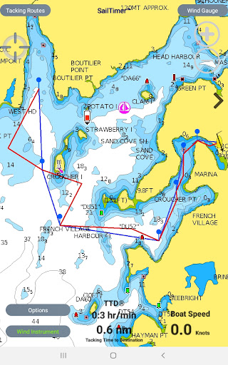
Standard GPS chartplotters and mapping apps do not account for sailboat tacking distances. But if they do not know the distance you will travel, how can they calculate your correct ETA? SailTimer gives you a quick and easy display of your optimal tacks and TTD® (Tacking Time to Destination).
Bonus: get a $25 discount on Speedy Trailer Lights™ or the SailTimer Wind Instrument™. Enter coupon code $25off in the shopping cart at www.SailTimer.co
App Instructions and Unique Features:
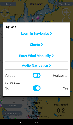
● Worldwide vector charts, Google Maps and aerial photos. If you have the Navionics Boating app, you can import your Navionics charts here with a yearly subscription. Navionics terms of use: SailTimerApp.com/vectorcharts.html
● Waypoints: Use the Tacking Routes button in the upper left to add new waypoints or to select from a list.
● Just select a route to see the optimal tacks to each waypoint. For wind, use the wireless SailTimer Wind Instrument™ (https://www.SailTimerWind.com) so that your tacks update automatically as the wind changes -- or enter wind speed/direction manually.
● When you pass a waypoint, press the > on the right side of the screen to go to the next waypoint. (Press < on the left side to see optimal tacks to the previous waypoint).
● The optimal tacks are the same headings whether you do the port or the starboard tack first. See the FAQs at http://sailtimerapp.com/FAQ.html for hints about avoiding obstructions by switching to the other tack.
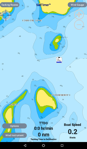
● The white crosshair icon in the top left is the “Follow-Me” button. If clicked, it turns blue and keeps your location in the center of the screen as you move. Unselect when not moving to look around the map, and when you want to zoom in and out.
● Polar plots: The app comes with a default polar plot for calculating optimal tacks (which you can edit). Plus, it can learn the custom polar for your boat.
● GPS track can be displayed under options. Save a screenshot to view or share your trip later.
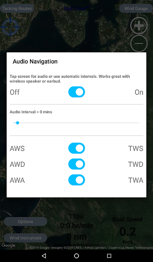
● Wind gauge button in upper right when using wireless Wind Instrument shows True and Apparent Wind Angle and Direction (TWD, TWA, AWD, AWA) in True-North and Magnetic-North reference.
● Audio feedback is available by tapping screen to hear wind conditions. (More audio features are available in the SailTimer Wind Gauge app).
If you are getting this free app and agree that these are helpful and unique features for sailing, please help out other sailors by letting them know, with a quick rating on this version while you’re here.
License Agreement: http://www.sailtimerapp.com/LicenseAgreement_Android.pdf
Navionics privacy policy and terms of use: http://www.sailtimerapp.com/VectorCharts.html.
For any questions, SailTimer Tech Support is prompt and helpful. We cannot provide technical support through comments here (and usually only see comments weeks later), but we are pleased to provide fast help if you email Tech Support at [email protected].