


Continuous improvement developement: crash fixes, bug fixes, and interface enhancements.
See full version updates for a full list of enhancements
myAIP lite is the demo version of myAIP.
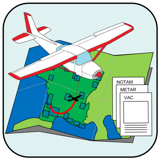
myAIP is a all-in-one application to assist you in preparing your VFR flights in France and in a large part of Europe!
It provides all the information and aeronautical safety for VFR with:
✔ TAF, METAR, SIGMET, raw and decoded (worldwide)
✔ NOTAM for airfields et FIR (worldwide);
✔ Display Visual Approach Charts VAC (France only), with updates following Airac calendar;
✔ Display AIP Supplements (France only);
✔ AZBA aeras for military activity (France only);
✔ Manage favorites and offline reading.
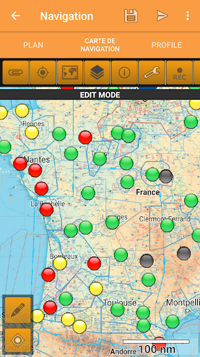
Create your flight plan simply,
✔ Updated Google Map.
- Many airfield across Europe (France, UK, Germany, Italy, Spain, Belgium, Netherland, ...)
- Beacons NDB, VOR, VOR-DME et TACAN,
- Automatically add turning point when design a flight path,
- Automatically look for the closest airfield to your flight path.
✔ Vertical altitude profil with airspace projection and ground,
- altitude can be modified simply by draging waypoints on the graphic, or with edition of the flight plan,
- accurate ground elevation retrieved from a Google DEM,
✔ Help define radionavigation parameters ;
✔ Automatically find nearby airfields;
✔ Summary of the collected information for your flight in one single pane;
✔ Send all the collected data (package ZIP) to your email for printing;
✔ Aircraft (DR300,DR400-{120,140,160,180},DA20,DA40,C152,C172,TB10)
✔ Weight an balance
✔ Fuel budget
✔ Compute aeronautical night;
And more,
✔ VAC are cached for offline access (in your Download directory)
✔ You can update information in the database and share it with other users of myAIP!
✔ You can add in the database your own waypoints for easy reuse in future flight plans;
✔ Works on tablets and phones!
✔ Checking of the validity of some information (VAC, METAR/TAF, ...)
The full version includes in addition
✔ Free airspace layer for France
✔ WINTEM and TEMSI maps (France and Europe);
✔ Additional Aeronautical products displayed on the map
✔ Export flight plan to GPS Exchange .gpx
✔ Export flight plan, fuel budget and weights balance to PDF file
✔ the project file can be stored on the cloud for an access from any of your devices