

• Tap on coordinates to copy them
• Long press on coordinates to change format
Other recent changes:
• Modify user point coordinates
• New maps: Swisstopo, Spain IGN and Drones restrictions
• Location sharing: share your location with your friends and see the friends who shared their location with you on the map
IGNrando’ is a collaborative platform for sharing routes and points of interest (POIs) related to outdoor activities in France.
Rich data offer
• Tens of thousands of routes and POIs all accross Metropolitan and Overseas France.
• Choose the activity, difficulty level and route length to find routes around you or near any other place.
• Download or mark as favorite the desired routes or POIs.
IGN & OSM maps
Choose from the best available maps for France:
• IGN maps: IGN maps of various scales
• IGN Top25: the famous 1:25000 French topo maps available at all zoom levels
• IGN Scan Express: most up-to-date topo maps with less topographic details for easy reading
• ICAO aeronautical maps
• OpenStreetMap Outdoors map: useful topographic map for border areas and other countries
• IGN Aerial photos: high resolution aerial and satellite images
• Slopes maps: transparent layer with 4 colors for slopes above 30°, useful for winter activites
• IGN Roads & paths: transparent layer with the road & path network of France
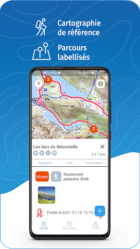
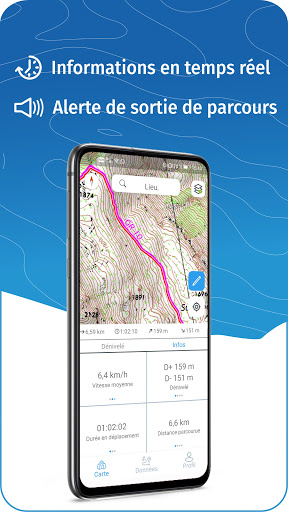
GPS guiding along the routes
• See your progression on the altitude graph
• Get alerted if you exit the route
• Get notified of upcoming POIs or route info points (available soon)
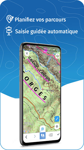
GPS tracking & data creation
• Record your own routes with GPS tracking
• Quickly create routes on-device with the automatic routing tool that follows roads and paths (online only, with subscription)
• Create POIs
• Sync your data on ignrando.fr website
Offline use
• Free downloading of Routes and POIs on your device for offline use
• Maps downloading with subscription
Useful tip: To improve battery life, use the app in Airplane Mode (or disable Mobile Data). Location Services (GPS) will remain active in Airplane Mode.
IGNrando’ Liberté yearly subscription
• Access to all maps and unlimited downloading of maps for offline use
• Manually create routes with the automatic routing tool
Use an SD card to store your data
Free space on your device.
——————————————————————
Got ideas to improve the IGNrando' app
Write us on: [email protected]