


Fix for problem with GPS and related crashes.
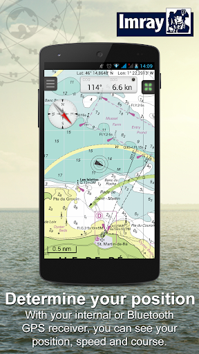
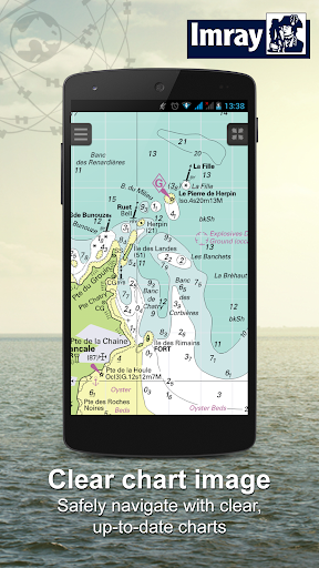
Navigation app with digital nautical charts for boaters and commercial shipping.
Note: You can purchase the charts in the app.
To get the most of these charts, we recommend that you use our app WinGPS Marine. This will make your Android device a complete and safe navigation system. Take a look on www.wingpsmarine.com for more information.
Coverage of the complete Imray serie is :
ID10: English & Scottish East Coast. Orkney Islands tot the Channel, incl. overview chart North Sea.
ID20: The Channel, with English and French coast.
ID30: British West Coast and Ireland.
ID40: Atlantic Coast of the Channel tot Gibraltar, incl. the Canary Islands, Azores and Medeira.
ID50: Mediterranean Sea West. Gibraltar to West coast Italy.
ID60: Mediterranean Sea Center. Adriatic and Ionic Sea: Slovenia, Croatia, East coast Italy and West coast of Greece.
ID70: Meditteranean Sea East. Aegean Sea: Western Turkey and Southeast Greace.
ID100: Eastern Caribbean Islands. Virgin Islands to Tobago.
What can you do with this app?
• Show current or last know location on the chart and set follow mode to automatic.
• Show your track.
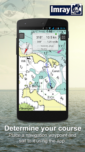
• Create your own waypoints and navigate to them.
• Instrument monitor shows you: course over ground (COG), speed over ground (SOG) and latitude & longitude (Lat&Lon) of your GPS. Also the course to steer (CTS), distance to go (DTG), time to go (TTG) and the estimated time of arrival (ETA) of your selected waypoint will be showed.
• Updates will be checked automatically when you start the app.
Sign in with your Stentec account and also use this chart on your Windows laptop using WinGPS navigation software. Take a look on www.stentec.com for more information.