
Add GDPR setting
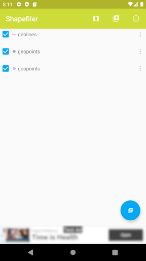
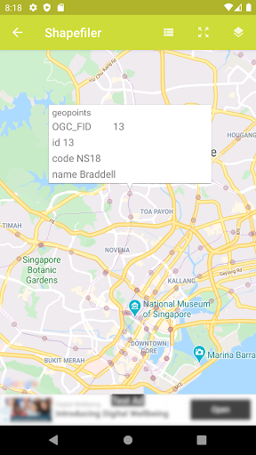
This app can load and display one or more Shapefiles with Google Maps as the base map. The overlay colors are randomly assigned by the app, but the user can bring up the layer properties to adjust the colors, opacity, and text labels. Polygon, line, point and text label features are clickable; once tapped, a snippet balloon will be displayed - a further tap will display the data attributes of the feature.
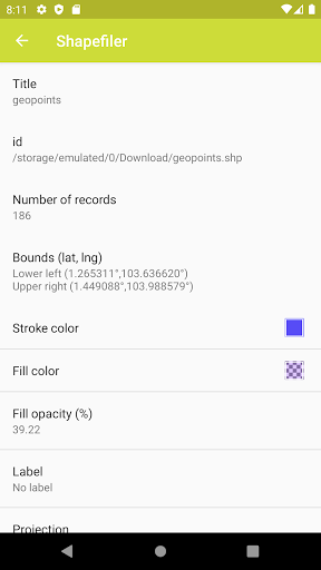
Only a limited set of source coordinate system types is available for this version, namely Geographic, and common projections like UTM, State Plane, Cassini-Soldner, Mercator, Transverse Mercator, with a choice of geodetic datums including WGS84. Unfortunately, user defined projection parameters are not available yet. Prj files are currently not used too.
The app will automatically remember the Shapefiles and layer properties without the user having to explicitly save the settings.