


Bug fixes and improvements
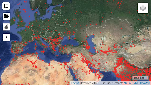
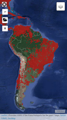
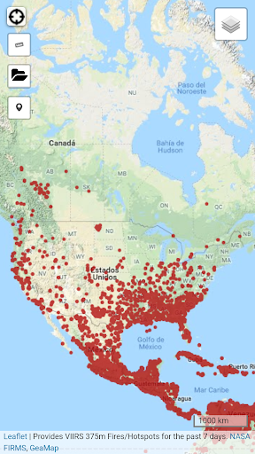
Firemap is a tool that allows you to visualize the latest fire events produced around the world. Quickly map the heat sources on a simple viewer allowing:
- Zoom in on the place
- Modify the cartographic database (orthophoto, topography and Open Street Map)
- Geopositioning through GPS
- Obtain data by measurements
- Draw maps with fire points
The cartography uses the data collected through the Terra satellite that NASA makes. This space detector carries with it different sensors, called MODIS and VIIRS, that capture the infrared radiation emitted by any fire. The information is treated quickly and made available to the public in a few hours. With all this we can know in a fairly objective way the approximate place where the fire occurred and the magnitude of it. More information at: http://ciencia.nasa.gov/science-at-nasa/2001/ast21aug_1/
Web:
http://www.geamap.com/en/fires