


General improvements
Important NOTE
Since there is no cellular reception in all areas of the Berchtesgaden National Park, the app is prepared for offline mode. Downloading the 3D map leads to increased amounts of data. We therefore recommend downloading the summer and / or winter map of the national park via WiFi.
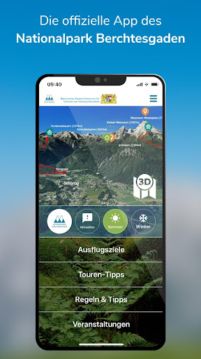
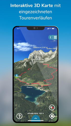
National park in 3D
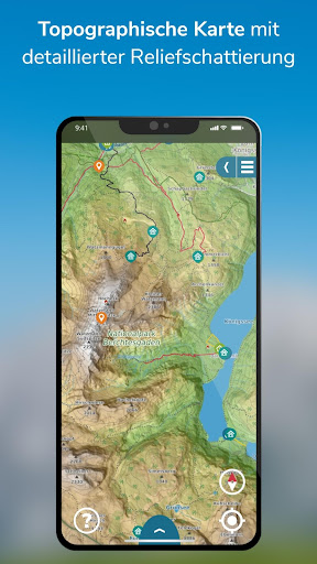
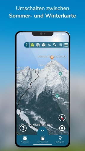
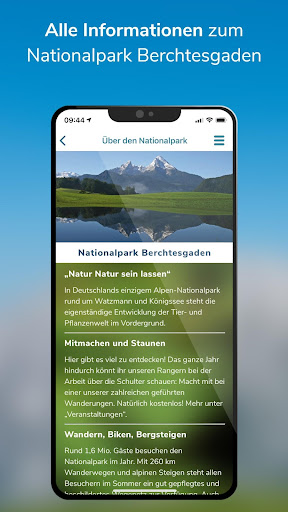
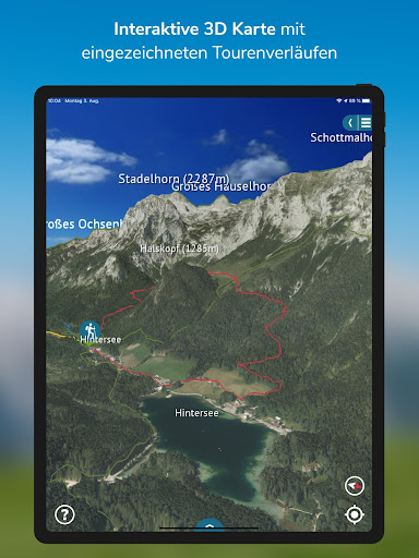
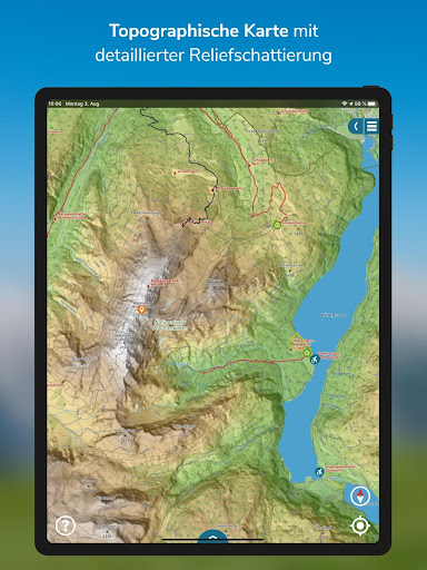
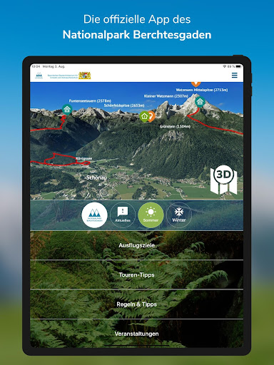
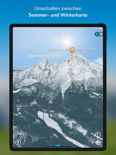
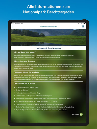
Experience, understand, protect: Up to 1.6 million visitors a year can now experience the Berchtesgaden National Park with a detailed 3D map. The unique high mountain landscape with its around 260 kilometers of well-developed hiking trails and alpine trails is shown as it really is. All important geographical information is integrated into the map. With an exact location function, your own position can be checked at any time. A change between 3D map, topographic map and aerial view is possible at any time.
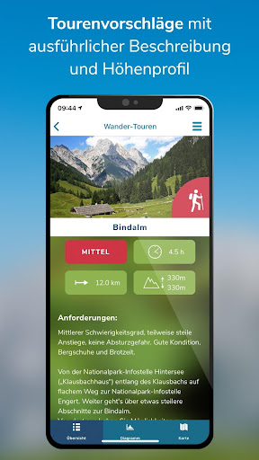
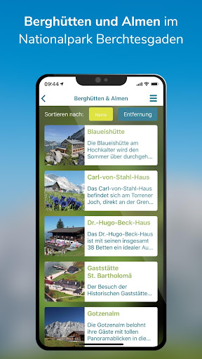
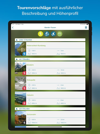
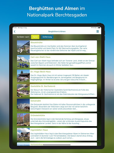
With this app, Germanys only Alpine National Park becomes a unique experience: 10 selected excursion destinations, 38 tour tips, from hiking tours to bike, snowshoe, ski to barrier-free tours. In addition, there are many tips on how to behave in the large protected area, as well as several webcams that offer up-to-the-minute pictures of the national park.
A great function for a tour experience in virtual reality is the "Virtual Panorama": Using this feature you can view a 360 ° panorama from any location, enriched with additional information such as mountain names and heights or points of interest such as e.g. restaurants - try it out!
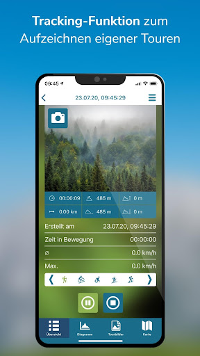
Tracking
The tracking tool is new in the app. It allows users to record their own tours. When the function is switched on, your own position, distance covered, duration of the tour and the current altitude are shown precisely. The tracking function facilitates orientation in the national park.
Events
Whether a guided tour into the realm of the marmots, a cross-border hike on old smuggler paths into the Austrian nature park Weißbach or a walk with the ranger - the national park app conveys a fascinating educational program and supports a fantastic adventure experience. This way, the visitor can find out about the offers of the national park before visiting.
Technical realization
3D RealityMaps
www.realitymaps.de